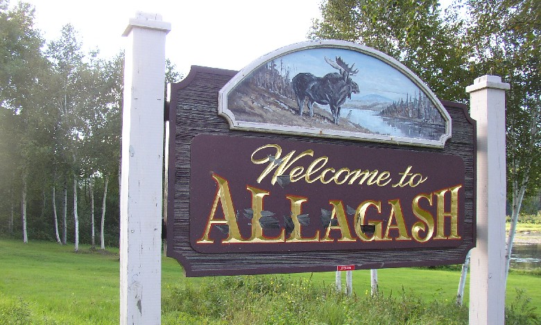
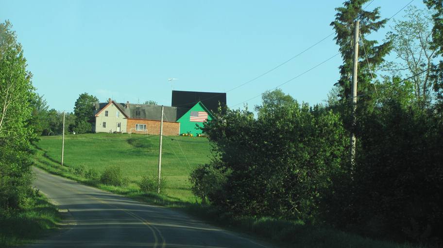
Allagash
Allagash is a town in Aroostook County at the mouth of the Allagash River, was organized on September 28, 1885, as a plantation from the townships of T16 R10, T16 R11, T17 R10, and T17 R11, all WELS. — Maine, an Encyclopedia.
Allagash is a town in Aroostook County at the mouth of the Allagash River, was organized on September 28, 1885, as a plantation from the townships of T16 R10, T16 R11, T17 R10, and T17 R11, all WELS. — Maine, an Encyclopedia.
Amity is a small town in Aroostook County, incorporated on March 19, 1836, from township T10 R01, also known as “Number 10.” Settlement began in 1826 with Jonathan Clifford, Jonathan Greenleaf, and Columbus Dunn. — Maine, an Encyclopedia.
Ashland is a “two township” town in Aroostook County, incorporated on February 18, 1862, from the township of T11 R5 WELS. In 1869 its name changed to Dalton, then back to Ashland in 1876. Sheridan plantation was organized on May 21, 1878, from T12 R5 WELS, then annexed by Ashland in 1901 to form its present boundaries. — Maine, an Encylopedia.
Bancroft is a town in Aroostook County, incorporated on February 05, 1889 as a town from Bancroft Plantation, which itself was formed from the unorganized township of Baskenhegan Gore, T1 R2. The railroad has been a presence in the village for many years. — Maine, an Encyclopedia.
Benedicta is located in southern Aroostook County. It was established as a plantation on February 1, 1873, with a population of about 400. Just over one hundred years later, in 1987, it surrendered its plantation status and became an unorganized township administered by the State. — Maine, an Encyclopedia
The Big Twenty Township is an administrative division in Aroostook County in northern Maine. It is one of the largest townships in Maine and contains Estcourt Station, a village of four people that is the northernmost point in Maine. The township also contains the northernmost point in New England. — Wikipedia
Blaine is a town in Aroostook County, incorporated on February 10, 1874, from the former Alva Plantation, which itself was organized on April 21, 1862. The town was named for Maine politician James G. Blaine. Blaine is a “half-township” town, forming a rectangle only half the size of the typical 6-mile by 6-mile square township. — Maine, an Encylopedia
Bridgwater is a town in Aroostook County, incorporated on March 2, 1858, from portions of the Bridgewater Academy Grant R1 Plantation and the Portland Academy Grant Plantation. Farming has been the major economic force in the town since the nineteenth century. It is home to Wood Prairie Farm, an organic seed and food products source with catalog and online listings. The town is located on U.S. Route 1, just south of Mars Hill. Bounded on the east by Canada, it hosts a U.S. Customs station at the junction of Blaine Road and Bridgewater Corner Road. — Maine, an Encyclopedia
Caribou is a City in Aroostook County, incorporated on April 5, 1859, as the town of Lyndon from Eaton Plantation and part of half township H. In 1869 Lyndon annexed Eaton, Sheridan, and Forestville plantations. On February 26th of that year, its name was changed to Caribou, then back to Lyndon on March 9th! Finally, on February 8, 1877, Caribou was confirmed as the town’s permanent name. Ninety years later, It was incorporated as a city on February 23, 1967. — Maine, an Encylopedia.
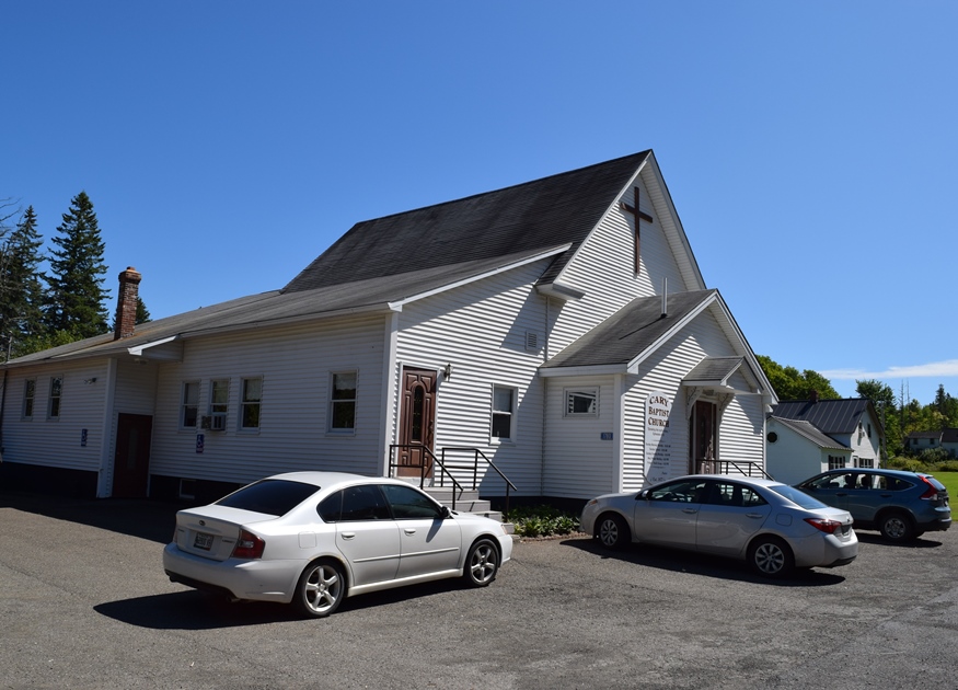
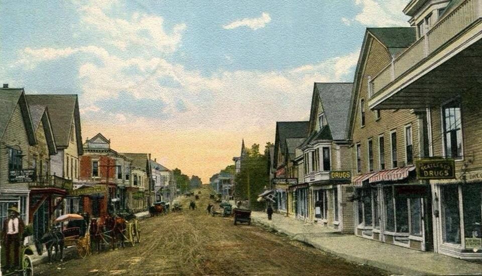
Cary has been a plantation in Aroostook County since its organizational status was confirmed on March 5, 1895. It had several legislative “organizations” as a plantation (1849, 1854, 1859) under the name T11 R1 WELS. The 1880 population was 413; in 1890, 390. With a population declining to 189, the plantation successfully “deorganized” the plantation in favor of becoming a township in June of 2019. The small population coincides with its physical size. Cary is what is called a “half township.” Most townships have been laid out to be six by six-mile squares. Cary, sandwiched between Amity and Hodgdon, is six miles east-west but only three miles north-south. Its “main street” is a little over three miles on U.S. Route 1. The name is in honor of Shepard Cary, a prominent lumberman in the area, State Legislator, and member of Congress. — Maine, an Encyclopedia.