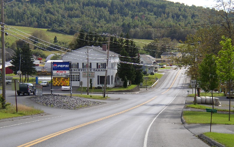
Eagle Lake

Eagle Lake is a town in Aroostook County, first organized for election purposes on July 11, 1859, from the township T16 R7 WELS. After many organizations and reorganizations, it was incorporated as a town on March 16, 1911. (Not to be confused with Eagle Lake Township in Piscataquis County.) Settled in the 1840s by Acadian-French and Irish immigrants, it was named for the many eagles at the Lake by a Major Strickland traveling north from Bangor during the Aroostook War period.

Read More »

Easton

Easton is a town in Aroostook County, incorporated on February 24, 1865, from Freemont Plantation. The name implies the “eastern” location of the town in Maine and in the County. Its population of over 800 in the 1880s supported eight public schoolhouses. Easton is a farming community southeast of Presque Isle, served by U. S. Route 1 and Maine Route 10.

Read More »

Forkstown

Forkstown Township is a cultural feature in the South Aroostook unorganized territory. It is in the grid just west of Amity. It appeared in the 1850 and 1860 Census, but not after that.

Read More »

Fort Fairfield

Fort Fairfield is a town in Aroostook County, settled in 1816 and incorporated on March 11, 1858, from Plantation D R1 and all of the Plymouth Grant lying southeast of the Aroostook River. It annexed Sarsfield Plantation in 1867. Fort Fairfield, established to protect the area during the Aroostook War, took its name from Maine Governor John Fairfield. The original fort (1839-1843), a duplicate of Fort Kent, was dismantled in 1862. A replica of the blockhouse was built in 1976 and is located in a small, quiet park just off Main Street. — Maine, An Encyclopedia

Read More »
Fort Kent Blockhouse

Fort Kent

Fort Kent is a town in Aroostook County, incorporated on February 23, 1869, from D’Aigle and Fort Kent Plantations. It lies across the St. John River from the small town of Clair, in Madawaska County, New Brunswick, Canada. Fort Kent is Maine’s northernmost town, but Big Twenty Township reaches even further north at about 47: 27′:30″ north latitude. — Maine, An Encyclopedia

Read More »
Frenchville Village

Frenchville

Frenchville is a town in Aroostook County, incorporated on February 23, 1869, under the name Dickeyville. The name was changed to Frenchville on January 26, 1871, in recognition of the French-Acadian population of the town. In 1899 it set off land to form Saint Agatha and ceded more land to the town in 1927. Its northern border is with Canada along a great bend in the St. John River. — Maine, An Encyclopedia

Read More »
North Maine Woods Checkpoint on American Realty Road in Garfield Plantation

Garfield Plt

Garfield, formerly No.11, Range 6, is a plantation in Aroostook County, first organized on March 26, 1883, organized again on April 13, 1885, and finally had its organization confirmed on March 5, 1895. This small plantation has struggled to stem population loss from 1970 through 2010. — Maine, An Encyclopedia

Read More »
Old Schoolhouse in Glenwood

Glenwood Plt

Glenwood is a plantation in Aroostook County, incorporated as a town on February 14, 1867, from Glenwood Plantation, that was organized for election purposes in 1863. After only a year, it surrendered its status as a town from 1868 through early 1877. On March 5, 1877, it became organized as a plantation. — Maine, an Encyclopedia

Read More »
Main Village at Grande Isle (2003)

Grand Isle

Grand Isle is a town in Aroostook County, incorporated on March 2, 1869, from Grant Isle Plantation. The name was changed to Grand Isle in 1872. It commemorates the large and fertile island within the town and in the middle of the St. John River just south of the village of Lille. — Maine, An Encyclopedia

Read More »
U.S. Inspection Station in Hamlin

Hamlin

Hamlin was a plantation in Aroostook County, organized on July 11, 1859, for election purposes and formally organized for general purposes on March 5, 1895. Originally, the township was known as Letter G R1, WELS. Now it is an organized town. According to George A. Varney in his Gazetteer, Hamlin’s population was 568 in 1870 and 612 in 1880, not much different from the current level.

Read More »